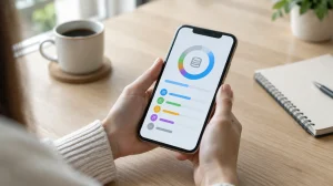
In fact, there are truck gps apps that can help you with your work.
With the democratization of the smartphone and the predominance of the Internet in our lives, the use of digital technology has gradually entered all of our daily actions. On the road, he is the ideal companion to keep in touch with our loved ones, but he is also the guide who always allows us to arrive safely.
In fact, very few drivers today they are trying to decipher a paper card to find their way. A simple look at our phone and we are sure we are on the right track.
Even better, he sometimes becomes a voice assistant and guides us without having to ask him.
With apps, it is now easy to benefit from the services of a Free GPS, provided, of course, that you know where to look. Therefore, throughout this article, you will see more about the best truck gps apps.
4 best truck GPS apps
Sygic GPS Navigation & Maps
Sygic GPS Navigation & Maps and the application most downloaded offline navigation app. It offers everything truck drivers need.
Drivers can select vehicle size, type, emission standards, hazardous materials and other parameters.
Thanks to these complex parameters, the application creates three optimal routes to choose from, avoiding sharp turns, inadequate bridges, tunnels and other truck restrictions.
Sygic also shares information about parking spaces and gas stations for trucks and buses.
Waze
The application Waze is an ideal choice to use in cities as it provides up-to-date online information about traffic jams, vehicle collisions, road closures, police officers and other possible road conditions.
It will automatically redirect you in case of a change in your chosen route. Additionally, you can search for places by name, not just address, which is extremely useful in the case of cafes and shops. The Waze browser only works with the Internet.

MapFactor Navigator Truck Pro
MapFactor Navigator Truck Pro is a application designed specifically for truck drivers, so it includes everything that could be useful to the driver during his trip.
Routes are established in real time taking into account the type, size and different restrictions of the vehicle.
The optimal route calculation, the availability of the latest traffic information, the continuously updated arrival time, the parking assistant, the clear interface – all these elements have made the navigator extremely popular among truck drivers.
moblander
CoPilot GPS – Navegação e Trânsito
It is difficult to compete with shipping giants like Google Maps or the Waze, but it is possible when it comes to offline use.
CoPilot GPS is the perfect app for situations where you're abroad and don't want to spend money roaming or stopping at every Wi-Fi station on the road and updating Google Maps. The app also has turn-by-turn voice directions and traffic reports.
The availability of offline maps is the only main difference between Google Maps and CoPilot GPS, so if internet access is not an issue, Google Maps or Waze are more advantageous.
What to look for before installing
- Size and memory usage. Utility applications should be lightweight. Those that exceed a few hundred megabytes often contain advertisements and trackers.
- Permissions that the application requests. It's the quickest test of reliability. A flashlight app that asks for contacts and location doesn't need that to work.
- Does the system already do that?. Android and iOS both come with built-in flashlight, recorder, document scanner, meter, and QR code reader. It's worth checking before installing yet another app.
- Billing model. Check if it's free with ads, a one-time payment, or a subscription. Subscriptions for simple tasks rarely make sense.
What these apps don't do
Before installing, it's worth managing your expectations: there are things that no app in this category delivers.
- Apps that promise impossible functions are often advertising platforms, and some request permissions they shouldn't.
- They are not a substitute for professional equipment. Cell phone sensors are for estimation, not for technically precise measurements.
- Cleaning apps don't permanently speed up your device: Android already manages memory on its own.
- No app actually increases battery capacity — what you can do is reduce consumption by turning off features.
Common questions
How do I know if an app is trustworthy?
Look at the developer, number of reviews, date of last update, and permissions requested. Those four together say a lot.
Does it work without internet?
Those that process locally, yes. Those that rely on a server require a connection and send their data externally.
Doesn't the cell phone already do that automatically?
It often does. Flashlight, recorder, document scanning, ruler, and QR code reader are native features in recent versions.
Do I have to pay to use it?
In most utilities, no. The free version with ads works fine, and the paid version is for removing ads.
Does it consume a lot of battery?
It depends on what's running in the background. Check the usage per app in the settings and restrict anything that's excessive.
Step-by-step to get started
- Compare the final price, including taxes. Baggage, seat selection, and service fees only appear at the end. The total is what matters.
- Download a map of the region before you travel. Offline mode needs to be prepared in advance and saved in case roaming fails.
- Keep the location services outside the app. A screenshot or the confirmation email will resolve the issue if the app doesn't open at the airport.
- Check the cancellation policy before booking. Promotional fares are usually non-refundable, and this rule is stated before purchase.
Traps that catch almost everyone
- Don't wait until you're at your destination to download the translator and map, when you don't have internet access.
- Thinking that the booking app can resolve flight cancellations — the airline is ultimately responsible.
- Match the search price without verifying the actual price at checkout — availability changes in real time.
- It does not have an offline map for real-time traffic information.
What the cell phone itself already does.
Google Maps saves entire areas for offline use, and the translator works without internet after downloading the language. Boarding passes are also stored in the phone's digital wallet, which opens without a connection.
What are the differences between a car navigation system and a truck navigation system?
A standard GPS solves a geometric problem: what is the shortest or fastest route between two points? A truck navigation system solves a restriction problem: which routes can my vehicle legally travel, considering its type?.
Therefore, configuring the vehicle profile is the most important part and the one that most people ignore. Here's what needs to be entered accurately:
- Total height, The measurement includes the load and any equipment on the roof. Being off by twenty centimeters here is what will cause a truck to rip off an overpass.
- Width and length, considering the complete set with the implement.
- Total gross weight and weight per axle. Bridge and roadway restrictions are usually based on weight, and some are based on axle load.
- Number of axles. It defines toll categories and various municipal restrictions.
- Dangerous cargo. It completely changes the permitted routes, especially in tunnels and urban areas.
Once configured, the route planner avoids prohibited roads and calculates travel time at a compatible speed — a loaded truck cannot climb a mountain at the speed of a car, and a route that ignores this generates an unrealistic arrival time estimate.
Urban restrictions: vehicle rotation, loading zones, and VUCs (Urban Cargo Vehicles).
The city is where truck drivers get into the most trouble, because the rules are municipal, change by region, and are almost never fully shown on the map.
In São Paulo, for example, there are restrictions on truck circulation in specific areas and time slots, with urban freight vehicles treated differently from larger vehicles, in addition to the city's vehicle rotation system based on license plate endings. Other capital cities have their own restricted zones, exclusive bus lanes, lanes prohibiting freight vehicles, and delivery time windows in the city center.
Practical points to avoid fines:
- Check the rules on the city hall's website before entering the city. No app guarantees complete coverage of municipal legislation.
- Pay attention to the schedules. Many restrictions only apply during certain times of day, and arriving 20 minutes early solves the entire problem.
- Registrations and special authorizations There are loading and unloading areas in several cities. Those who always travel to the same destination should make arrangements.
- Be careful with the detour suggested by the app in traffic jams. Alternative routes often place the vehicle on a narrow road with a sharp curve and low clearance.
Template, weight, and what the map doesn't know.
Restriction databases are inherently incomplete. They depend on data collection and updating, and Brazil has hundreds of thousands of kilometers of roads. What is usually missing:
- Height of wiring and branches, which is not on any map and drops cargo on a residential street.
- Weight limit for smaller bridges, indicated only on site.
- Recent works and closures.
- Radius of curvature. A return that the map considers possible may be impractical for a long set.
- Ramp. Few bases take inclination into account, and it determines whether the loaded vehicle can go uphill.
Two practices compensate for this limitation. The first is to look at the entire route before leaving, instead of following instruction by instruction—two minutes of reading the route reveals suspicious sections. The second is to use street view at unfamiliar delivery points to check width, clearance, and maneuvering space before arriving with the vehicle.
And the golden rule of transportation applies: when the sign on the road contradicts the app, the sign wins. Always.
Work schedule, rest periods, and what the law requires.
Law 13.103/2015 regulates the working hours of professional drivers, and route planning must take it into account. The key points are:
- Rest every four and a half hours. uninterrupted driving, with a minimum interval of 30 minutes, which can be broken up.
- Meal break for at least an hour.
- Daily rest Eleven hours within each 24-hour period, with the possibility of splitting the workday under the conditions stipulated by law.
- Mandatory time tracking, by manual, mechanical or electronic means.
Navigation apps for trucks often allow users to mark stops and estimate arrival times based on rest periods. This significantly changes the prediction on long trips: a 900 km journey isn't covered in nine hours, and planning as if it were is what leads to tired drivers.
It's also worth mapping out rest stops with facilities in advance—service stations with parking, showers, food, and security. Choosing where to sleep with a loaded vehicle is a safety decision, not a comfort one.
Offline map: the most forgotten item
A large portion of Brazil's road network has patchy data coverage. The GPS itself continues to function without internet access because it receives signals from satellites and doesn't depend on the mobile network—what disappears without a connection is the map, real-time traffic information, and route recalculation.
Preparation that solves the problem:
- Download the map of the travel regions. Before leaving, use Wi-Fi. Offline maps take up hundreds of megabytes to a few gigabytes per state.
- Update the maps regularly. Height restrictions and road closures are changing, and a map from two years ago is a risk.
- Bring a sturdy support and a good quality charger. Browsing with the screen on consumes more energy than many car chargers deliver, and the phone still discharges even when plugged in.
- Configure before starting. Using a cell phone while driving is a very serious offense, punishable by a fine and seven points on the driver's license.
- Have a plan B written down or in your memory. Knowing the numbering of the main highways along your route avoids relying entirely on the screen.
Finally, a note about the estimated arrival time: it's calculated based on average speed and doesn't take into account the queue at the weigh station, unloading time, full parking lot, or rain in the mountains. Promising a specific time to the customer based on the number on the screen is the quickest way to create pressure to drive faster than is safe.