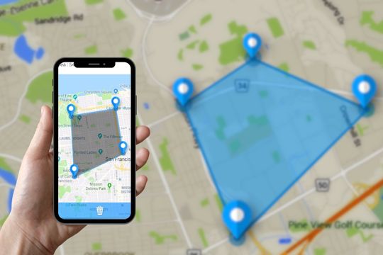
In the digital age we live in, practicality has become paramount, permeating all spheres of our lives, from communication to how we manage daily tasks. In this context, innovative solutions emerge that transform simple mobile devices into powerful work tools. A tangible example of this transformation is the use of apps to measure land and areas directly from a cell phone. These tools have become indispensable allies for construction professionals, agronomists, architects, and even individuals who simply want to quickly measure a personal space. First of all, it's important to clarify one point: what these apps deliver is a... I estimated. The reading depends on the GPS signal and satellite image, usually varies by a few meters more or less, and does not replace a topographic survey done by a professional — which remains the valid method for deeds, registration at the notary's office, boundary disputes, and projects approved by the city hall.
The benefits of using smartphone apps for this purpose are numerous: time savings, reduced costs for specialized equipment, and the ability to obtain immediate, reliable data for budgeting, planting planning, or quickly clarifying doubts. With just a few taps on the screen, it's possible to map extensive areas, calculate perimeters, and get a detailed overview of the space in question. These technologies represent a qualitative leap in terms of accessibility and efficiency, democratizing processes previously restricted to professionals with specialized equipment.
Main Applications on the Market
In the current market, a variety of applications promise to transform your cell phone into an effective tool for measuring land and areas. Below, we will explore some of the most prominent ones, highlighting their main characteristics and functionalities that make them attractive choices for different needs and contexts.
Google Earth
Google Earth is a powerful tool that allows users to view 3D maps of anywhere in the world, including approximate measurements of areas and distances. With this application, it's possible to access satellite imagery, which facilitates detailed terrain mapping—keeping in mind that the image may be months or years old and that the tracing is done manually, which introduces an element of error. In addition to its basic measurement functionality, Google Earth offers features such as visualizing geographic changes over time, providing a dynamic perspective on the development of a given area.
GPS Fields Area Measure
Specifically designed for measuring large areas, GPS Fields Area Measure is ideal for professionals in agriculture, surveying, and civil construction. This application uses the device's GPS to estimate areas and perimeters, allowing users to save and share their measurements. The result tends to be closer to reality in large, open areas; in small plots, with dense vegetation, or between tall buildings, GPS variation is much greater. One of its great advantages is its intuitive interface, which facilitates use even for those less familiar with georeferencing technologies.
Land Calculator
The Land Calculator stands out for its simplicity and effectiveness in measuring areas and perimeters. This app is a great option for anyone who needs a quick, hassle-free tool. In addition to measuring land, Land Calculator also offers features such as calculating costs associated with the measured area, making it useful for financial planning in construction and agricultural projects.
MapPad
MapPad is another robust solution for measuring land and areas. It offers advanced features such as exporting data to geographic information systems (GIS), as well as allowing you to create personalized maps based on your measurements. This application is particularly useful for professionals who need to integrate their measurements with other planning and territorial analysis software.
Measure Map
Finally, Measure Map is a versatile tool that allows users to measure distances and areas in a variety of units of measurement. Compatible with Google Maps and Google Earth, this application offers advanced features such as measuring multiple areas simultaneously and exporting data to various formats.
Advanced Features
In addition to the ability to measure land and areas, many of these applications offer a set of advanced features that expand their possibilities of use. This includes integration with geographic information systems (GIS), allowing territorial analysis
More detailed data, including exporting data to formats compatible with other professional software, facilitates collaboration and planning in larger-scale projects. The ability to easily save and share measurements is also a significant advantage, allowing work teams to access the same up-to-date data regardless of their geographical location.
Another relevant aspect is the incorporation of satellite imagery and 3D maps, which provide a deeper understanding of the terrain to be measured. These features help avoid gross errors in the design and also offer a broader view of the environmental and urban context of the area analyzed. Thus, these applications transcend the simple measurement of areas, transforming themselves into complete tools for territorial analysis and planning.
FAQ: Perguntas Frequentes
Q: Are land measurement apps accurate?
A: They are useful, but they provide an estimate, not an official measurement. The variation depends on the device, the quality of the GPS signal, vegetation, surrounding buildings, and the age of the satellite image. To verify, measure the same area twice: if the values match closely, the estimate is consistent.
Q: Can I use these apps for professional measurements?
A: For internal use — budgeting, planting planning, figuring out how much material to buy — they work well. For any legal or contractual purpose, such as deeds, registration, subdivision, or boundary disputes, the best course of action is to hire a qualified surveyor or engineer: only a professional survey has formal value.
Q: Do I need an internet connection to use these applications?
A: Some applications require an internet connection to access up-to-date satellite images and maps. However, many offer offline functionality, allowing measurements to be taken even without internet access.
Q: Can I save and share measurements taken?
A: Yes, most applications allow you to simply save, export and share measurements, making it easier for work teams to access this information and for documentation purposes.
Conclusion
Mobile apps for measuring land and areas have changed the way professionals and enthusiasts take initial measurements of physical space. With functionalities ranging from basic measurement to advanced territorial analysis, these tools have become quite useful in sectors such as civil construction, agriculture, architecture, and urban planning. Just don't confuse the roles: they serve to estimate, compare, and plan quickly; when the number needs to have formal value, a professional topographic survey remains irreplaceable.
How to use it in practice
- Restart before concluding that it's slow. Much of the slowness disappears with a restart, without needing any application.
- Move photos and videos to the cloud. After confirming the backup, release the local copy. It usually returns several gigabytes.
- Uninstall anything that hasn't opened in months. The list by usage time is in the settings. It's the most lasting way to save space.
- Clear the cache of larger applications. You can do it app by app in the settings, without installing anything, and without losing your login or settings.
What goes wrong most often?
- Deleting an application folder through the file manager can result in lost data that cannot be recovered.
- Granting accessibility permission to a utility that doesn't need it.
- Installing a cleaner that promises to speed up your phone — Android already manages memory on its own, and the gains don't last.
- Install three utilities that do the same thing, all running in the background.
The alternative that is already included in the system
Android and iPhone already include features like a flashlight, voice recorder, document scanning, QR code reader, ruler, compass, level, and screen recording. Before installing, it's worth checking the settings – many people install what they already have.