
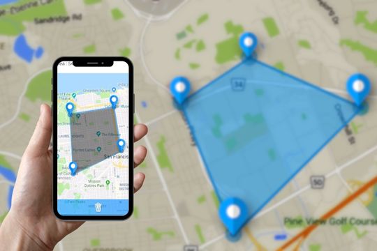
In the digital age we live in, practicality has become a watchword, permeating all spheres of our lives, from communication to the way we manage everyday tasks. In this context, innovative solutions are emerging that transform simple mobile devices into powerful work tools. A tangible example of this transformation is the use of applications to measure land and areas directly via cell phone. These tools have become indispensable allies for construction professionals, agronomists, architects, and even for individuals who just want to quickly measure a personal space.
The benefits of using applications on smartphones for this purpose are numerous: time savings, reduced costs with specialized equipment and the possibility of obtaining immediate results with surprisingly high precision. With just a few taps on the screen, it is possible to map large areas, calculate perimeters and obtain detailed information about the space in question. These technologies represent a qualitative leap in terms of accessibility and efficiency, democratizing processes previously restricted to professionals with specific equipment.
Main Applications on the Market
In the current market, a variety of applications promise to transform your cell phone into an effective tool for measuring land and areas. Below, we will explore some of the most prominent ones, highlighting their main characteristics and functionalities that make them attractive choices for different needs and contexts.
Google Earth
Google Earth is a powerful tool that allows users to view 3D maps of anywhere in the world, including measuring areas and distances accurately. With this application, you can access updated satellite images, which makes it easier to map terrain in great detail. In addition to its basic measurement functionality, Google Earth offers features such as visualizing geographic changes over time, providing a dynamic perspective on the development of a given area.
GPS Fields Area Measure
Specially designed for measuring large areas, the GPS Fields Area Measure is ideal for professionals in agriculture, topography and construction. This application uses the device's GPS to provide accurate estimates of areas and perimeters, allowing users to save and share measurements taken. One of the great advantages is its intuitive interface, which makes it easy to use even for those less familiar with georeferencing technologies.
Land Calculator
The Land Calculator stands out for its simplicity and effectiveness in measuring areas and perimeters. This app is a great option for anyone who needs a quick, hassle-free tool. In addition to measuring land, Land Calculator also offers features such as calculating costs associated with the measured area, making it useful for financial planning in construction and agricultural projects.
MapPad
MapPad is another robust solution for measuring land and areas. It offers advanced features such as exporting data to geographic information systems (GIS), as well as allowing you to create personalized maps based on your measurements. This application is particularly useful for professionals who need to integrate their measurements with other planning and territorial analysis software.
Measure Map
Finally, Measure Map is a versatile tool that allows users to accurately measure distances and areas using a variety of measurement units. Compatible with Google Maps and Google Earth, this application offers advanced features, such as measuring multiple areas simultaneously and exporting data to different formats.
Advanced Features
In addition to the ability to measure land and areas, many of these applications offer a set of advanced features that expand their possibilities of use. This includes integration with geographic information systems (GIS), allowing territorial analysis
more detailed, up to the export of data to formats compatible with other professional software, facilitating collaboration and planning on larger-scale projects. The ability to simply save and share measurements is also a significant advantage, allowing work teams to access accurate, up-to-date information regardless of their geographic location.
Another relevant aspect is the incorporation of satellite images and 3D maps, which provide a deeper understanding of the terrain to be measured. These features not only increase the accuracy of measurements, but also offer a broader view of the environmental and urban context of the analyzed area. Thus, these applications transcend the simple measurement of areas, becoming complete tools for territorial analysis and planning.
FAQ: Perguntas Frequentes
Q: Are land measurement apps accurate?
A: Yes, many of these apps offer surprisingly high accuracy, especially those that use up-to-date GPS and satellite imagery. However, accuracy may vary depending on the device used and GPS signal conditions.
Q: Can I use these apps for professional measurements?
A: Although these applications provide accurate results, it is always recommended to double-check measurements for professional purposes, especially in projects that require extreme precision.
Q: Do I need an internet connection to use these applications?
A: Some applications require an internet connection to access up-to-date satellite images and maps. However, many offer offline functionality, allowing measurements to be taken even without internet access.
Q: Can I save and share measurements taken?
A: Yes, most applications allow you to simply save, export and share measurements, making it easier for work teams to access this information and for documentation purposes.
Conclusion
Applications for measuring land and areas via cell phone represent a revolution in the way professionals and individuals access precise information about physical space. With functionalities ranging from basic measurement to advanced territorial analysis, these tools have become indispensable in various sectors, such as construction, agriculture, architecture and urban planning. In addition to practicality and time savings, the ability to integrate these measurements into broader planning and analysis processes offers a significant competitive advantage, demonstrating how technology can be used to improve our interaction with the world around us.